Transportation Investment Act Your Penny, Your Progress
On the Road with TIA
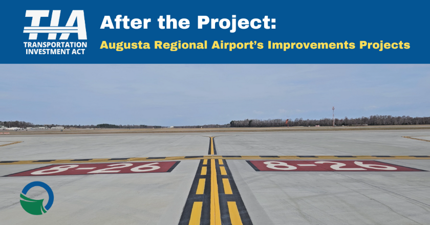
After the Project: Augusta Regional Airport's Runway Rehabilitation and Apron Expansion Projects
Improvements at the regional airport will enhance economic and social development - especially through the city's special events
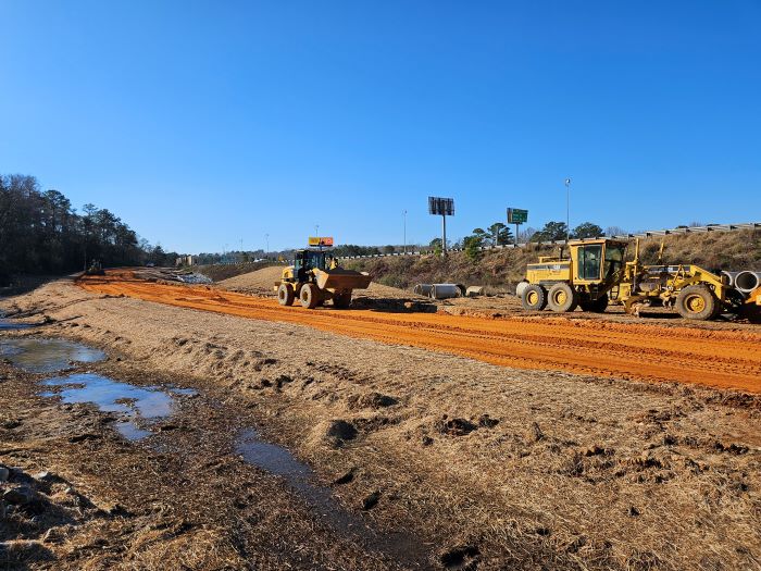
Did you know that Georgia has 103 public use airports? Out of that seemingly high number, only eight have regularly scheduled airline services. Of course, Hartsfield-Atlanta International Airport is the state's flagship airport with nearly 52 million passenger flights per year (most recently counted in 2019), with the Savannah-Hilton Head International Airport coming in second with nearly 1.4 million. At the third spot is Augusta Regional Airport with just over 300,000.
Regional airports are invaluable to Georgians around the state, especially those whose homes and businesses are several hours away from Hartsfield-Atlanta. Even so, nearly every airport's home community struggles with challenges like updating technologies, infrastructure maintenance, environmental factors and competition. All of these issues essentially point to one simple truth: like most ventures, it takes money to make money.
When developing their final investment list of projects for their second decade of TIA participation, the Central Savannah River Area (CSRA) region's leadership roundtable included four airport projects in Augusta-Richmond County to make long-awaited improvements at two facilities: two at Daniel Field and two at Augusta Regional Airport. Both of the Augusta Regional Airport projects recently completed major construction, and in our latest short video airport leaders explain the significance of the facility to both Augusta and the CSRA, and why TIA investment is crucial to both the city's and region's success.
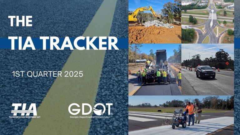
Want to check out our progress on the hundreds of TIA projects underway statewide? Check out our new quarterly video - The TIA Tracker - for the latest stats and highlights from our participating regions. It's a quick watch, and easily accessible. Click here for the video.
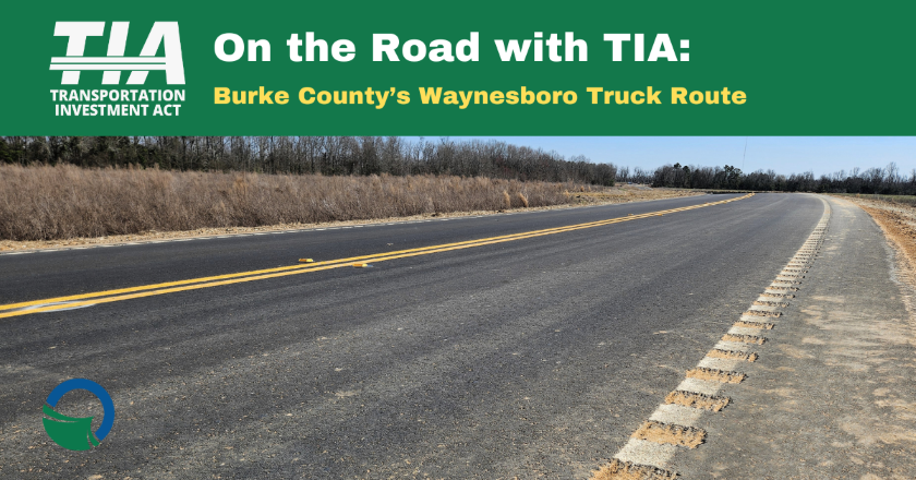
On the Road with TIA: Burke County's Waynesboro Truck Route
A designated route for large trucks will improve traffic efficiency and safety for everyone
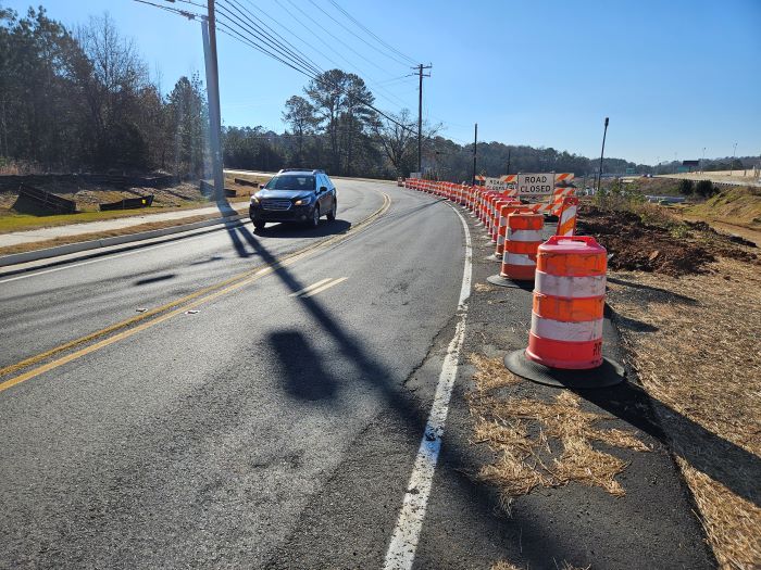
Economic and civic growth in counties and cities inevitably means more large truck traffic. Decades ago, communities were just fine with narrow, two-lane streets, a tightly-built downtown or government and commercial district, and neighborhoods set on grids with neat four-way stops, as commercial vehicles were much smaller and not as numerous. Today, however, a typical semi truck is 72 feet long, 8.5 feet wide, 13.5 feet tall and they can weigh as much as 40 tons (80,000 pounds!) loaded. With hundreds of these vehicles driving through older civic lay-outs and infrastructure, it's no surprise that traffic safety and efficiency are negatively affected. Many municipal areas are tackling the big truck problem by constructing designated routes just for them.
In this video series, we're taking a look at projects that are underway in TIA regions, why they were selected for program inclusion and how they're expected to resolve issues in their communities. Local officials and TIA staff recently held a ribbon-cutting ceremony for the new Waynesboro Truck Route, and were excited at the prospect of improved traffic through the area. Click here to discover why they're celebrating.
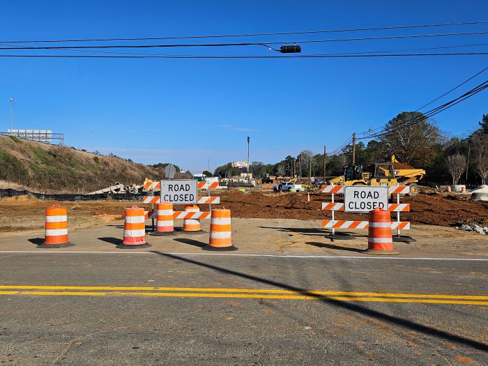
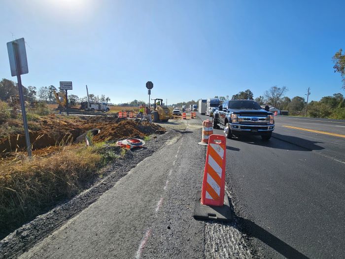
Muscogee County: Cusseta and Old Cusseta Road Improvements in Columbus
Watch your new Interstate 185 interchange emerge through 2025
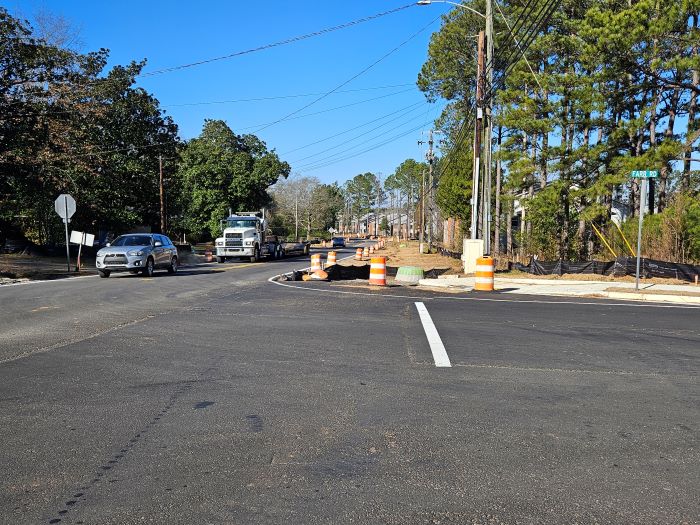
Even with the recent holiday season and our current spate of cold weather, contractors and crews adding an Interstate 185 interchange at Old Cusseta Road have made a huge amount of progress over the past couple of months. The most visible sign of the future interchange is the demolished segment of Farr Road that until recently ran alongside the Interstate 185 overpass. Project plans required the elimination of this portion of Farr Road to make room for the interchange's ramps. The second most visible sign of the future interchange is the newly-graded land along the south part of the overpass that will eventually become an off-ramp.
A couple of weeks ago, contractors opened the just finished - new signage and everything - realigned section of Farr Road that starts at what used to be C Street and then shifts traffic to the east, goes around Parkway Place Apartments and connects to Old Cusseta Road about a block from Bedford Avenue. If you use a GPS system to get around Columbus, please know that some of these apps have not yet updated their maps. As of this blog posting, there were still pop-up closure alerts for Farr Road. If your route uses Farr Road through this area, you can take the new segment and end up very close to where you used to go.
Meanwhile, over on the other side of this project, you may encounter a long row of utility teams on Cusseta Road near Odis Spencer Stadium, where they're moving lines to make room for a new paved multi-use trail that will run along a widened roadway. At the Cusseta Road and Old Cusseta Road merge point, contractors will later convert the 'traffic triangle' into an easier-to-navigate roundabout. With all the orange-and-white barrels everywhere and teams sometimes working on both sides of the roadway, driving alert and paying full attention to surroundings through this area is a must.
Project engineers and contractors have scheduled completion of this project to occur in spring of 2026. With a bit more than a year's worth of work to come, most of it will be focused on the transformation of the Interstate 185 overpass into a fully-functional interchange. Strategically, having the new exits to and from Old Cusseta Road just before the interstate's terminal interchange at US 280 in the Fort Moore region will allow motorists, especially commercial truck drivers, to have more route options and flexibility on Columbus's south end. Those who will eventually travel more directly to their destinations by using the future Old Cusseta Road interchange will relieve traffic entering and exiting the interstate from the Fort Moore area as well as the more northward interchange at St. Mary's Road. More efficient traffic flow equals safer and happier drivers, which also equals a happier community overall.
Posted 1/9/2025 7:03:00 AM by Penny Brooks; Updated 1/9/2025 8:17:36 AM
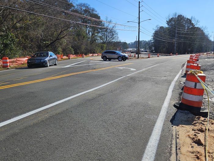
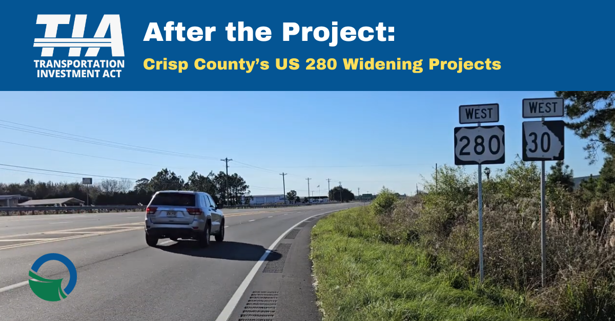
After the Project: Crisp County's US 280 Widening Projects
Two more links in Georgia's US 280 'Power Alley' increase safety, opportunities
US 280 crosses Georgia from Columbus in the west to Savannah in the east, and while it has been a priority corridor for development for decades, some host counties have had difficulty making the improvements that would help them capitalize on its strategic location. While selecting projects for TIA funding in the River Valley region, leaders have selected several sections of US 280 for widening and other enhancements and in the past ten years, two of those large projects in Crisp County have been completed: the widening of the US 280 bridge over Lake Blackshear and the US 280 widening from the Lake Blackshear bridge to the SR 300 connector in Cordele.
In this video series, we're taking a look at projects that were recently completed in TIA regions, why they were selected for program inclusion and how they're expected to resolve issues in their communities. Click here to hear local leaders discuss how widening US 280 in Crisp County will provide boost driver safety as well as enhance both economic and civic progress.
Jefferson County: SR 4/US 1 Widening from Mennonite Church Road to SR 540
You'll see a variety of crews in action through this work zone - make sure they're not distractions
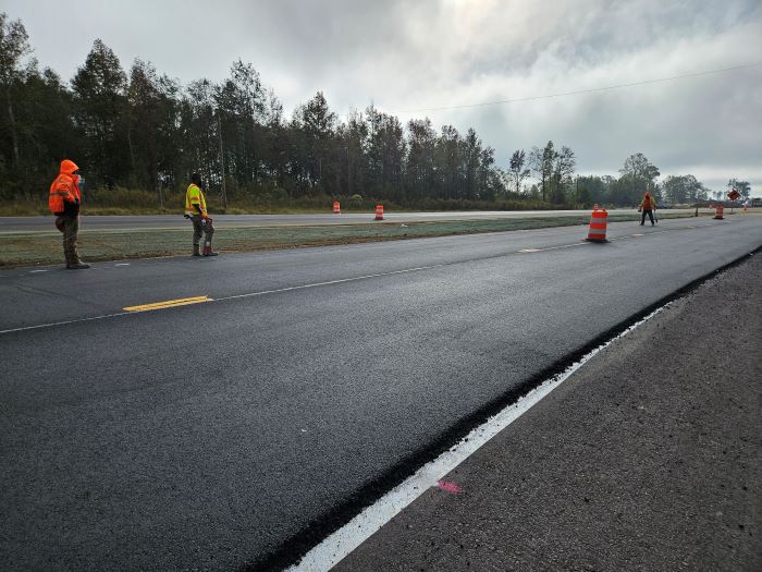
There are six projects widening segments of SR 4/US 1 in the TIA 1 and TIA 2 final investment lists. Three are located in the Central Savannah River Area (CSRA) region and three are in the Heart of Georgia Altamaha (HOGA) region. Overall, SR 4/US 1 extends north and south through east-central Georgia, from Charlton County at the state's southern border all the way to the Augusta Metro area. As a primary transportation corridor, it's not surprising that local leaders and officials from two participating TIA regions chose to widen several sections of the highway, three in Appling and Toombs Counties in HOGA and three in Jefferson County in CSRA. One Appling County project located near Georgia Power's Plant Hatch has already completed major construction, but the all the other five projects are currently in construction.
For Jefferson County, having three sections of SR 4/US 1 under construction end-to-end has created a long construction work zone, with teams doing an assortment of tasks at varying stages of progress. Drivers traveling from Louisville to Wrens will encounter a number of crews and vehicles, and it's interesting to see all the progress underway at various points. It also takes some dedicated focus to maintain attention to the roadway and not get distracted by the range of activities.
For an extended example of the different crews a driver may encounter on this stretch of highway - and how they may steal focus - let's take a photographic drive through the northernmost project segment, which extends from SR 540 at Wrens southward to the Mennonite Church Road intersection.
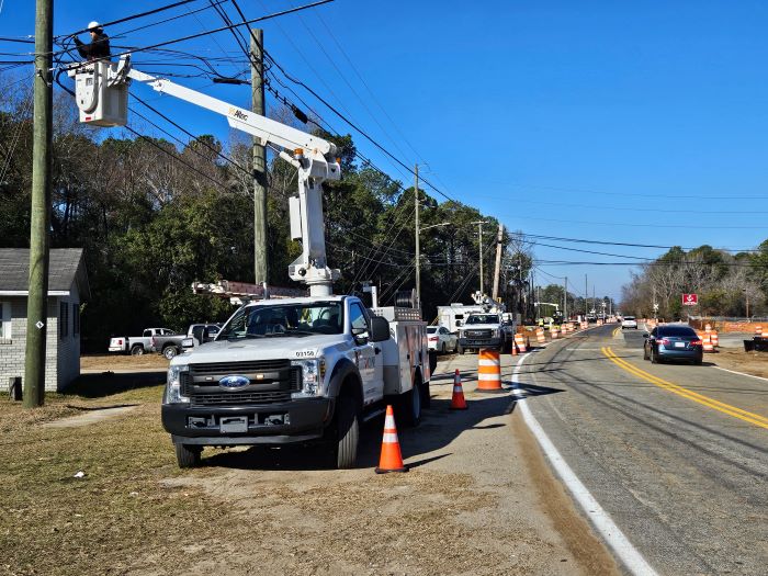
At SR 540, the long rows of orange and white barrels show drivers that this project won't be a brief one and that they need to be alert. With only a three minute drive southward, we encounter our first crew and a traffic shift. While the project is 86% complete and much of the roadway already layered with new asphalt, there are places here and there where it is yet to be laid. Here, a backhoe is moving dirt and a tractor is leveling it, preparing the land for a new lane coming in. With large vehicles in the median, drivers on both sides need to be attentive to their movements.
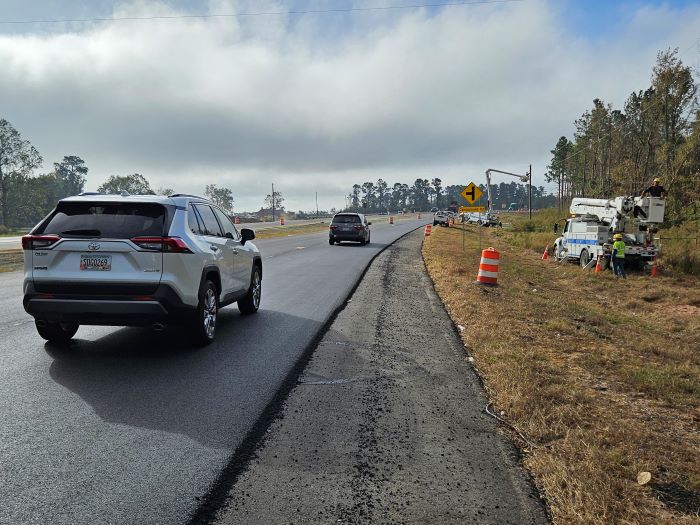
After driving for only four more minutes, we see a small team of workers on the edge of the road. They're marking the new asphalt to ensure that the stripes they'll paint later in the day will be according to state policy. While they're all wearing their fluorescent protective gear for visibility and are behind barrels, it's easy to imagine how an inattentive motorist could cause a near miss or worse. Just a minute southward again, and we have some surprise utility crews! They're not with this construction project but were called in the early morning hours to respond when a vehicle hit a power pole in nearby right-of-way. Bucket trucks can be fascinating to watch in action, but drivers need to stay focused to avoid additional accidents.
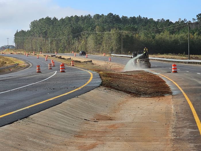
After driving an additional four minutes, we pass a curious truck with a worker spraying a weird blue substance all over the dirt on the roadsides. If you start wondering what the blue stuff is, you're now driving a bit distracted! After a query to construction engineers, you'll be happy to know that the stuff is called hydroseed, a mixture of grass seed, water, fertilizer and wood fibers.
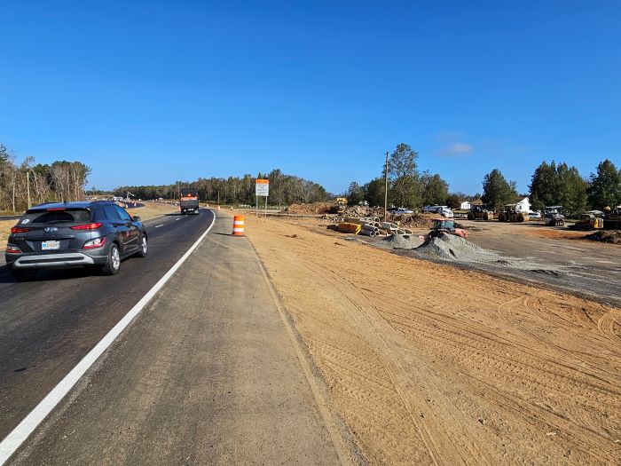
After another three minutes driving southward, we reach the project's southern end at Mennonite Church Road and Warrior Trail near Jefferson County High School. After making a U-turn and reaching Campground Road, we see the project's staging area just off the roadside. It's a large dirt area with piles of dirt, gravel and other materials, concrete pipe segments and trucks moving here and there and often entering and exiting the roadway. If you have kids, it's fun to identify the different construction vehicles, watching them lift and carry heavy loads, and now we're driving a bit distracted again. In this section of the project, it only takes a moment of inattention to the roadway to develop a dangerous situation.
When we get back to the SR 540 intersection, there's yet another crew that started work after we left. If a business or home has a driveway that's connected to a highway construction project, project planners are required to ensure that the driveway is repaired or replaced. This team is finishing up a local business's new driveway and resetting road signs. It's a bit of work to get a road sign installed according to state requirements, and seeing a stop sign bob up and down can definitely be a distraction.
The trip from this project's end to end only took 15 minutes each way, and yet we encountered six work teams in medians, on roadsides and sometimes in the lanes. That averages to happening upon a different group every 2.5 minutes. On one hand, we can be excited that so much is underway in this work zone and soon the region will have a bit more of this corridor expanded and resurfaced to accommodate growing numbers of commercial trucks for economic development as well as passenger cars driven by new residents and neighbors. On the other hand, if you're not used to moderating your driving to be safe and focused through work zones, you could be taking a number of risky chances passing the groups of workers, their equipment and trucks. And don't forget - this is just one of three segments of SR 4/US 1 in a row that are under construction. Georgia DOT's advice to #DriveAlert and #ArriveAliveGA while dealing with the multiple projects may be a challenge, but it's one that will keep everyone safe while long-anticipated transportation improvements are underway.
Posted 10/31/2024 8:09:00 AM by Penny Brooks; Updated 11/1/2024 7:05:27 AM
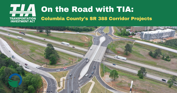
On the Road with TIA: Columbia County's SR 388 Corridor Projects
Quick population growth prompts practical traffic management solutions
It's often exciting when a large corporation or government agency relocates to a new community. After the enthusiasm calms down, local officials have to figure out how to accommodate the changes that come with a sudden influx of residents, and that includes infrastructure adjustments to handle increased residential and business traffic.
In this video series, we're taking a look at projects that are underway in TIA regions, why they were selected for program inclusion and how they're expected to resolve issues in their communities. Click here to discover how improvements to Columbia County's SR 388 corridor at Interstate 20 are expected to affect traffic flow in an area experiencing a wave of growth.
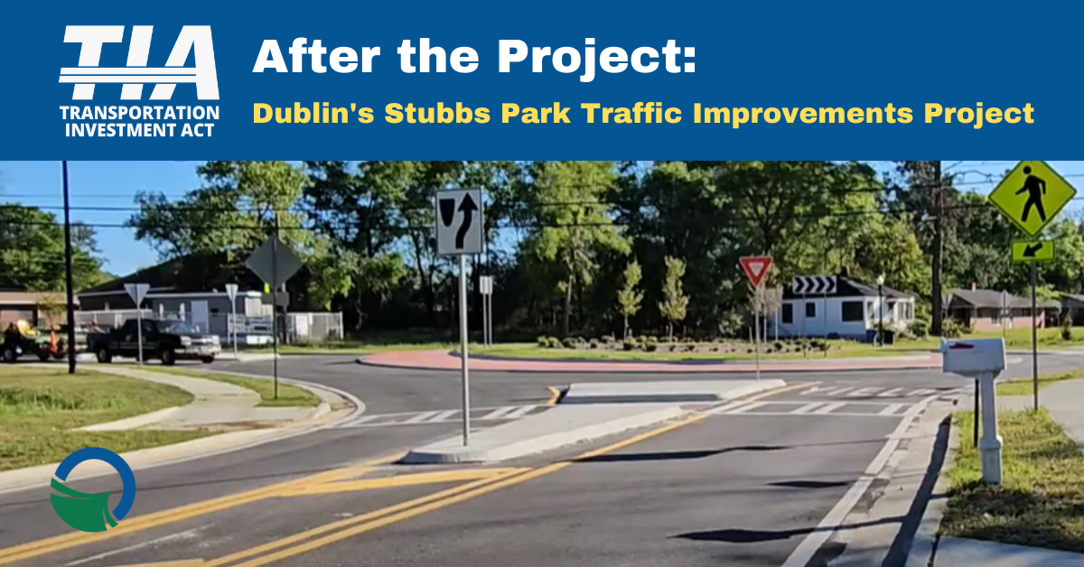
After the Project: Dublin's Stubbs Park Traffic Improvements Project
Traffic safety and efficiency is a necessary part of neighborhood and park revitalization
Dublin officials are working through a citywide neighborhood revitalization program, and for the Stubbs Park neighborhood those plans include changes to traffic patterns. In this video series, we're taking a look at how completed TIA projects are benefitting their communities. Click here to see how improving traffic flow and developing a repurposed neighborhood space is upgrading a community and enriching the city.
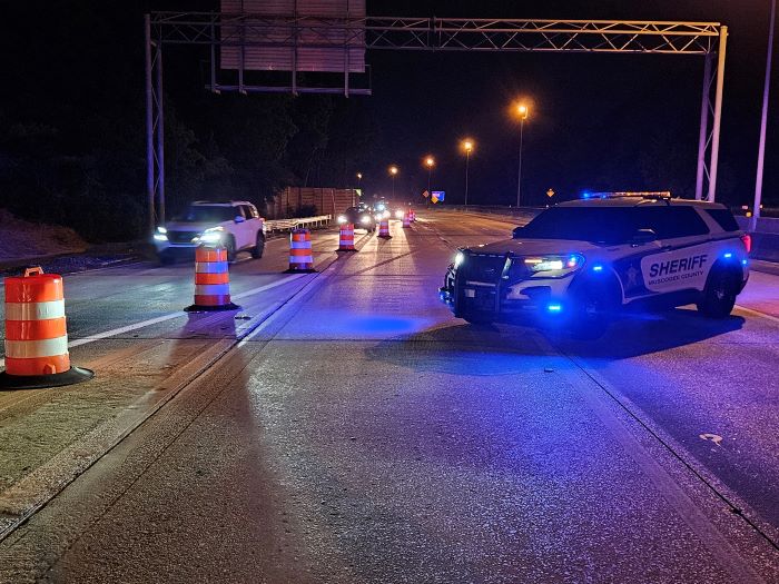
Muscogee County: Buena Vista Road Interchange Improvements in Columbus
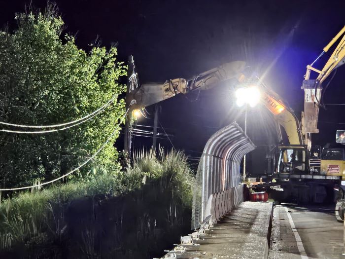
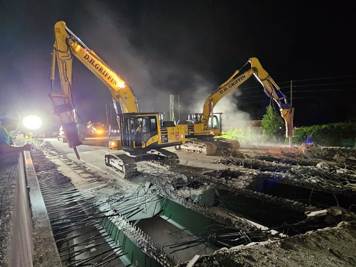
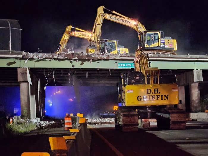
Safety is the priority during an overnight overpass demolition
Last weekend, May 10 - 12, 2024, multiple construction crews cooperated to demolish the remaining Buena Vista Road overpass bridge at Interstate 185. There are many ways to take down a concrete structure, and project engineers ultimately decided the most effective operation would involve: 1) working in overnight shifts, when there's less traffic; 2) removing half of the bridge at a time, the west end on the first night and the east end on the second; 3) closing the interstate lanes through the area and redirecting traffic to use the on- and off-ramps to get around the activity; and 4) using huge hydraulic jackhammer vehicles to quickly break up the concrete and rebar.
With various coordinated teams participating, the overnight driving public remaining in the vicinity and tons of rubble to be created and then removed, keeping everyone and everything in the area safe and secure was the ultimate goal. Yes, working quickly and making sure that resources were being used carefully were also important, but time and costs can be managed if necessary. Peoples' lives and livelihoods must always be protected and preserved, as unaffected as possible by the construction.
The photos and details shown below are from the first night of the demolition, but the process remained the same for both nights.
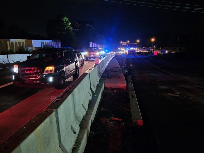
On Friday, May 10, the first safety step of the night involved enacting the traffic control plan. The Columbus Consolidated Government and Georgia DOT both made announcements through broadcast and social media in the weeks prior to the construction event, alerting local and regional residents to the interstate lane closures. The project's contractors set up message boards in advance of the construction site as an additional notice.
At 9:00 p.m., a crew started by setting out orange-and-white barrels to direct through-traffic to the on- and off-ramps, while officers with the Muscogee County Sheriff's Department and Columbus Police Department gradually blocked the interstate lanes and then monitored traffic through the area throughout the process. At times they also temporarily closed traffic to the newly-completed overpass, and a couple of times had to deal with a motorist who wasn't paying attention and managed to get around the barriers. All in all, however, the vast majority of drivers patiently and safely passed alongside the demolition.
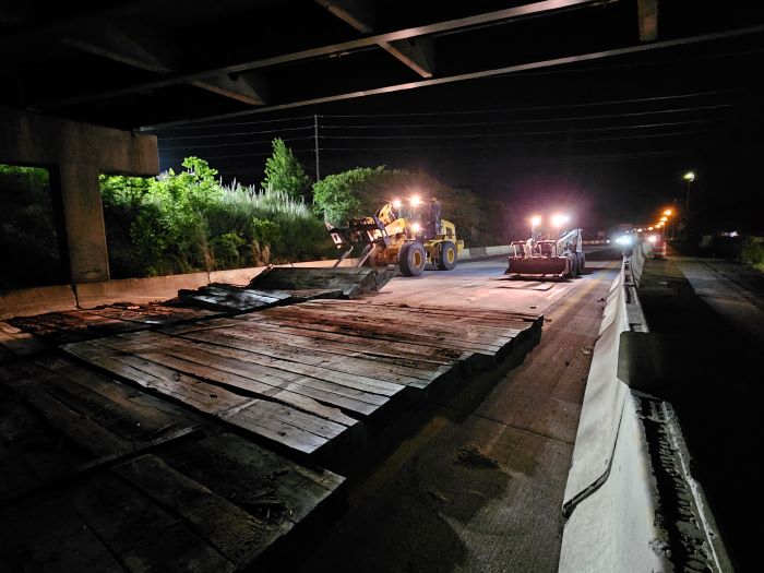
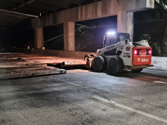
In addition to protecting people and their vehicles, the construction plan also ensured that the roadway underneath the bridge remained undamaged and able to be reopened to traffic at dawn. Part of the evening's prep work involved a two-worker team: one in a backhoe with a forklift who set loads of large wooden beams underneath the overpass, and another in a Bobcat with a grapple attachment who then lined up all the beams evenly. Huge chunks of concrete could then fall on the shock-absorbing beams and keep the road safe.
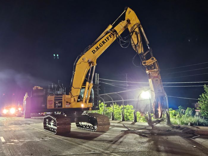
One of the largest construction vehicles of the night was equipped with what's called a 'shear,' a huge, sharp claw that can cut through metal like scissors cut through paper. The demolition shear was called in for two important safety tasks: 1) to take down the remaining metal features from the overpass, like the pedestrian safety fence, and 2) to cut down nearby power lines. Utility crews had already moved the power from the nearby lines to a new cables located away from the interchange, and with a few huge snips, the old lines were out of the way.
Finally the prep work was complete and team members in the giant jackhammer vehicles could start the actual bridge demolition. Operating in tandem, they jabbed in patterns through the concrete and rebar, and the old overpass fell in pieces down on top of the waiting wooden beams. With full safety measures in place, the jackhammers could operate fairly quickly leaving the steel beams to be then handled by the demolition shear and crew members who removed the metal pieces.
When the west end of the bridge was finally completely downed, the teams cooperated to ensure every bit of metal and rubble - as well as the wooden beams - were taken away in time for the interstate's morning commuters. The traffic control measures were lifted at 6:00 a.m., and drivers likely only fleetingly realized as they were on their ways to work, school or home that half of the old overpass was suddenly gone. It's that way with safety plans, though: when you take all necessary steps and do them correctly, most people won't notice anything at all.
Posted 5/16/2024 7:59:00 AM by Penny Brooks; Updated 5/17/2024 8:27:06 AM
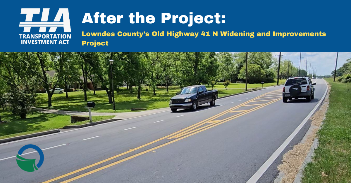
After the Project: Lowndes County's Old Highway 41 North Widening and Improvements Project
Improving infrastructure for residential safety and efficiency is key to growth
Lowndes County and City of Valdosta leaders are improving infrastructure as part of their goal to become a prime South Central Georgia hub. In this video series, we're taking a look at how completed TIA projects are benefitting their communities. Click here to discover how improving a county highway is one way to engage future residents.